 |
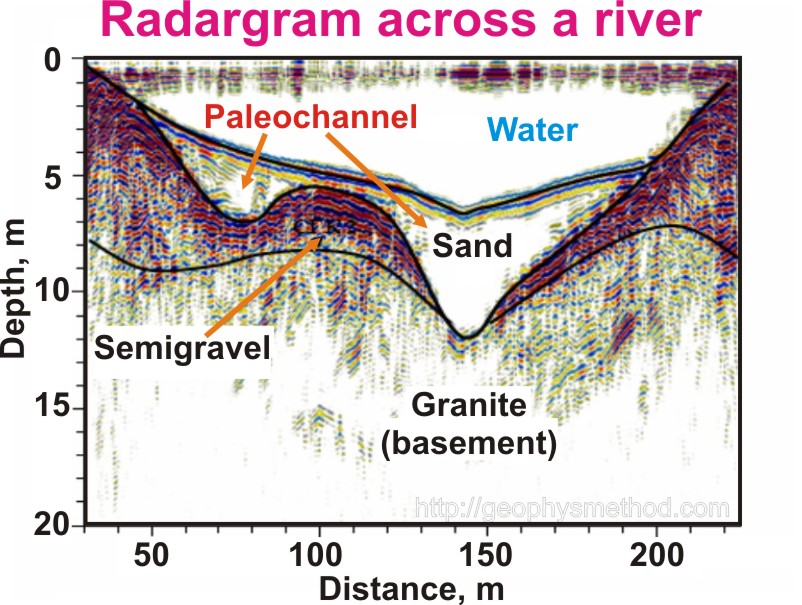
GPR (Ground Penetrating Radar) The method Ground Penetrating Radar (GPR) belongs to the group of high-frequency wave electromagnetic fields (EM). GPR method includes the formation of a wave signal followed by the registration of its reflection from objects (boundaries) with different electro-physical properties. Currently, the method is widely used in a detailed study of lithological shallow geological boundaries in the framework of engineering-geological surveys, in a detailed survey of the state and monitoring of engineering objects (buildings, structures, auto and railway roads, strengthening slopes of hydraulic structures, etc.), in the localization of hidden near-surface heterogeneity (caverns, fractures) in the studied section affecting the methodology of field development, drilling, etc. The main GPR advantage is a high spatial resolution which provides high detail of the study. Depending on the problem and the object study, GPR depth can vary from n*10cm to n*10m.
|